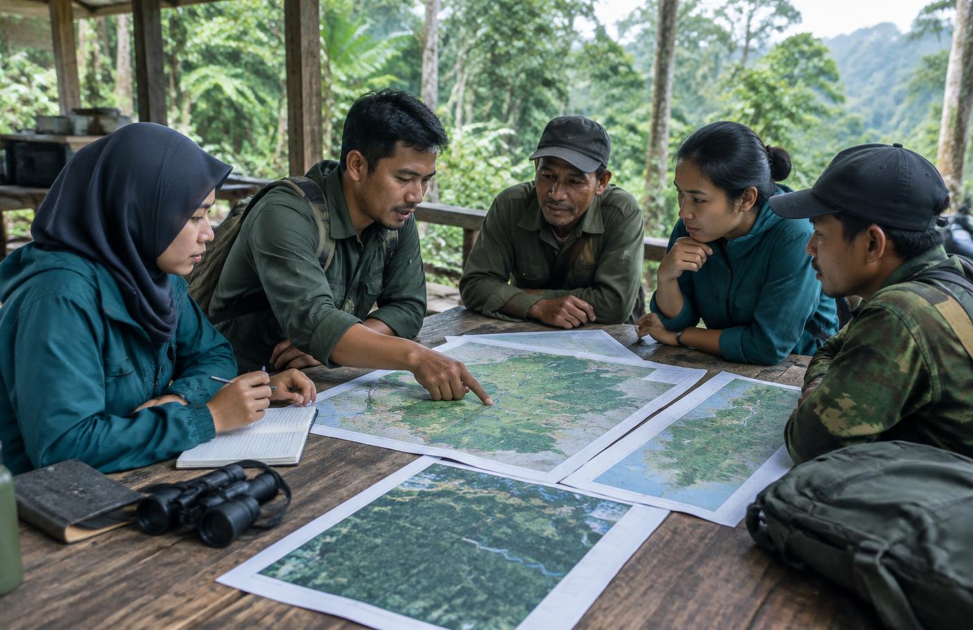
Rattan, honey and river fish
Families stay on the Meratus ridge when there is income that does not rely on the mine. The programme is attaching buyers to rattan, honey and river fisheries.
South KalimantanPeoplePartnership
Restoring Degraded Landscapes, Strengthening Forest-Based Livelihoods, and Advancing Climate Action
South Kalimantan stands at a critical intersection between forest conservation, climate resilience, and sustainable regional development. Its forests play a vital role in regulating water systems, storing carbon, sustaining biodiversity, and supporting rural livelihoods. However, these landscapes face growing pressures from land-use change, mining, forest encroachment, fires, and land degradation. Between 2016 and 2020, the province recorded approximately 68,899 hectares of gross deforestation, while forest and land fires affected around 249,808 hectares during 2015–2020. In 2018, approximately 280,094 hectares were classified as critical land and 224,428 hectares as severely critical land.
These environmental pressures are closely linked to the province’s vulnerability to climate-related risks and natural disasters. The severe flooding in 2021 highlighted the importance of landscape resilience, watershed management, and sustainable land use. Addressing these interconnected challenges requires more than isolated conservation or rehabilitation activities. It calls for integrated action that strengthens forest governance, restores degraded landscapes, promotes sustainable forest-based livelihoods, and improves coordination between environmental management and regional development.
While South Kalimantan has implemented various forestry and environmental initiatives through provincial and national programmes, additional investment and targeted interventions remain important to address persistent gaps. The RBP REDD+ GCF Output 2 Programme provides an opportunity to complement existing efforts by connecting forest protection and rehabilitation with community livelihoods, institutional strengthening, and more effective landscape management, contributing to long-term emission reduction and climate resilience.
Gross Deforestation (2016–2020)
Forest and Land Fires (2015–2020)
Critical Land Area (2018)
Severely Critical Land (2018)
Forest Degradation (2018–2019)
Critical and Severely Critical Land within Forest Areas
Avoided emissions
Not published. The provincial baseline is under review and no figure will be shown until it is settled.
South Kalimantan is at a critical crossroads in protecting its remaining forests, restoring degraded landscapes, and strengthening the foundations of sustainable development. Persistent deforestation, forest and land fires, and land degradation underscore the need for integrated action that connects forest protection, institutional strengthening, and community livelihoods. Why South Kalimantan matters:
Protecting forests and restoring landscapes. Strengthening forest governance, patrols, fire prevention, and rehabilitation to reduce environmental pressures and sustain ecosystem functions.
Empowering communities through sustainable livelihoods. Expanding Social Forestry, agroforestry, silvopasture, and non-timber forest product enterprises to make sustainable forest management economically beneficial for local communities.
Building lasting REDD+ institutions. Strengthening Forest Management Unit capacity, provincial REDD+ governance, emissions monitoring, safeguards, and benefit-sharing systems to sustain climate action.
9
Forest governance strengthened across 9 FMU and 1 Tahura; 250 ha of critical forest and land rehabilitated; 910 forest-fire patrols and security operations
Capacity-building support for Social Forestry groups and forest farmer groups in forest management and enterprise development.
Provincial REDD+ policies and institutions strengthened: REDD+ Strategic and Action Plan, FREL/FRL documentation, MRV system, Benefit-Sharing Mechanism, REDD+ Safeguard document, and a ProKlim Roadmap all completed
13
13 ProKlim (Climate Village) areas assisted; 10 Community Fire Prevention Groups (MPA) trained; 16 mitigation support packages delivered for mineral and peatland areas 250 hectares
Critical Land Area (2018)
The programme aims to strengthen South Kalimantan’s forest resilience as a foundation for climate mitigation, disaster risk reduction, and sustainable community development. In the long term, it seeks to safeguard forest ecosystems, sustain the livelihoods of forest-dependent communities, and enhance the province’s resilience to climate-related risks. In the near term, the programme focuses on maintaining deforestation and forest degradation emissions below their respective Forest Reference Emission Level (FREL) allocations of 1,469,285 tCO₂e and 817,873 tCO₂e, respectively. Through integrated investments in forest protection, landscape restoration, sustainable forest management, community livelihoods, and REDD+ governance, the programme aims to sustain emission reduction performance while strengthening the institutional and social foundations for long-term climate action.
Protecting forests and reducing emissions
Strengthening the operational capacity of nine Forest Management Units (KPH) and one Grand Forest Park (Tahura) to improve forest protection, routine patrols, fire prevention, and management planning.
Restoring degraded landscapes and strengthening resilience
Supporting the rehabilitation of 250 hectares of critical forest and land, complemented by planning and coordination to ensure that restoration contributes to wider landscape-management priorities
Building sustainable forest-based enterprises
Building the capacity of 558 members of Social Forestry groups and forest farmer groups, while supporting agroforestry, silvopastoral systems, and non-timber forest product enterprises that can improve productivity and market access. Strengthening REDD+ and climate governance The programme supports the development of provincial REDD+ planning and technical instruments, including FREL/FRL, MRV, benefit-sharing arrangements, safeguards, greenhouse gas inventory reporting, and the integration of safeguards information into SIS REDD+. ProKlim activities extend climate adaptation and mitigation support to communities across the province.
Families stay on the Meratus ridge when there is income that does not rely on the mine. The programme is attaching buyers to rattan, honey and river fisheries.
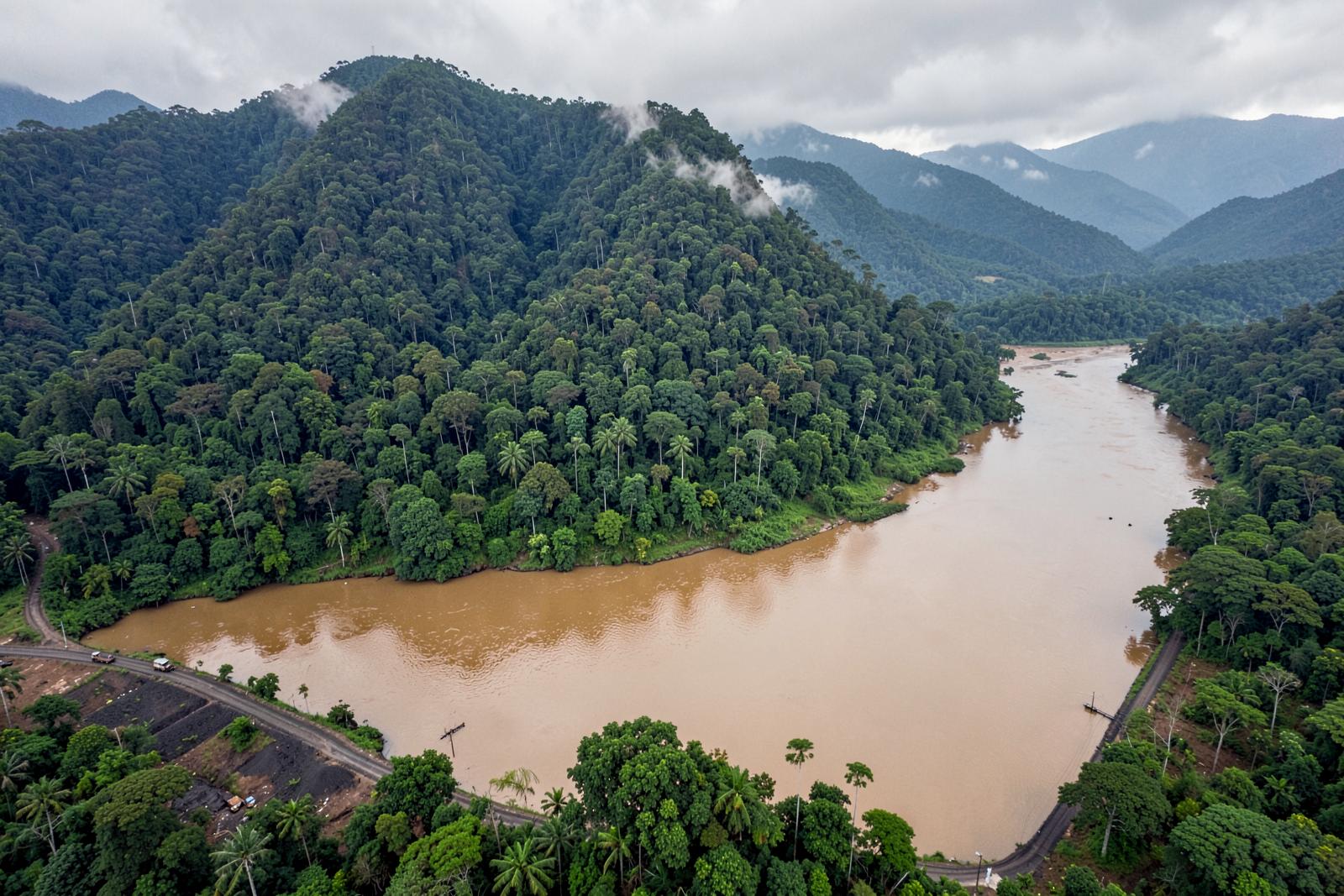
Where a haul road meets the forest, new cutting shows up first. Community patrols in the Meratus log it with GPS points and photographs.
A customary boundary and a coal haul road now run within sight of each other. One of them is on the official map.